Well, it has taken me some time to pull these thoughts together. Lots of emotions are in play here. While I did not finish, and had to withdraw about 30 miles from the end, it was quite the adventure! This was by far the hardest thing I have ever attempted and even with the dejection of a DNF, I feel there were a great many positive take-aways from this. Below you can find things that stood out for me, and things that may help others considering this race. There are also other good blogs out there for prospective Spine participants. One of the best blogs is from Ian Bowles. I had the pleasure of chatting with Ian for a while at the finish, and I find his approach and views of this event to be very similar to mine. Look him up.
I went into this race with lots of apprehension. Being definitely out of my element I must put out a big thank you to Neil Rutherford, Anna Buckingham and Douglas Braidwood who were kind enough to put forth their perspectives and answer my questions about preparations. You all made this a much better experience and got me closer to Kirk Yetholm than I would have done on my own.
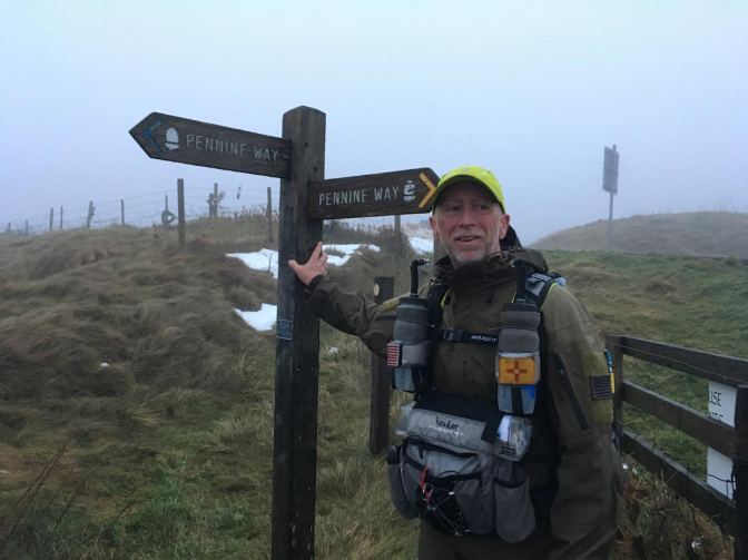
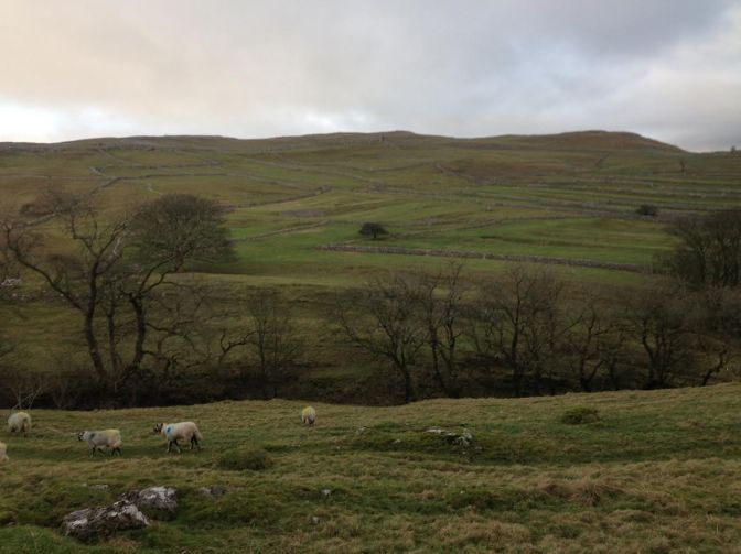
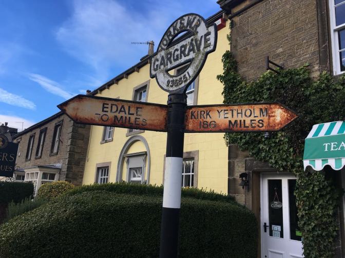
But now a quick recap. For those who may not know, the Spine is a 270-mile multi-day race across northern England along the Pennine Way, in winter. Billed as England’s “most brutal race” it starts in Edale, southeast of Manchester and heads north to the Scottish border ending in Kirk Yetholm. There is a very high DNF rate for this race. Think cold, wet and dark.


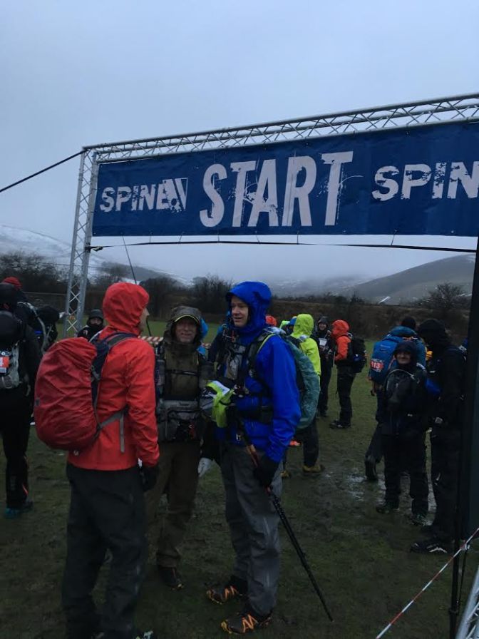
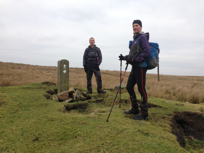
My race began well enough. I had trained well, my kit was in order and I was mentally prepared. The start was delayed about 30 minutes due to the time it took to get everyone checked in. The first day was what I expected; rain, slush, cold, wet, stream crossings, etc. I got off course about three times, mainly from not paying attention, but I was getting into the swing of it. Additionally, my first encounter with the flagstones that cross the many bogs of the Pennine Way was a little unnerving. They were icy and covered with dark water so you could not see if you were landing on the stone or in between them! During the day, I ran with Tim Peutz an American from Washington DC, and I eventually caught up and spent some time with Canice Harte from Park City.
I made it just beyond Wessenden Reservoir by dark. I worked my way along, occasionally glancing back to see headlamps in the distance behind me. At the crossing of A672 (just before the M62), there was a hamburger stand set up for the racers. Hmm. Since there were some just coming off the grill, I bought one and ate as I walked along. It was good, but I had no green chile to go with it! Shortly thereafter I met Tim Miller whom I would spend the better part of the next several days with. He had previously finished the Challenge, a shorter distance version, and had attempted the Spine the year before but had to withdraw. It was my good fortune as he had knowledge of the course, was an orienteer, and appeared to be moving at the same pace as me. For my benefit (Tim knew the course/race) and for the company, I decided to try and stick with Tim.
We worked our way past the reservoirs north of the White House Pub and eventually came upon Stoodley Pike Monument. The large edifice appeared quite creepy in the foggy dark. We eventually linked up with a hand full of other racers and made our way to Hebdon Hey Scout Center (CP1). Arriving at 15 hours and 19 minutes, my plan was to not spend a lot of time here since it was crowded and noisy. I ate, repacked and then snoozed in a chair for 45 minutes. Since I lost track of Tim at the CP and having not made any definite plans, I left with Helene Dumais, a French Canadian who is the wife of Tim Puetz (whom we saw coming into the CP just as we were leaving). Unbeknownst to me, my traveling buddy Tim Miller was still in the CP sleeping.
Once daylight came, I was moving with another runner whose name escapes me until Cowling, where he dropped off and Tim caught up with me. Linking up, we pressed on until Gargrave where we set down in a pub for a bite. No beer to wash it down with, but a large Coke hit the spot. My wife Lisa joined us there.

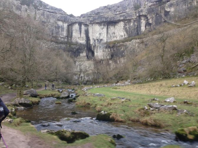
Refreshed, we made our way towards Malham. The stairs up Malham Cove were intimidating and once I neared the top, wished that I had counted them. Finally, after 39 hours and 21 minutes we made the Malharm Tarn Field Center. We dropped our packs, ate a bite and rested prior to pushing on at dusk. Skirting Fontains Fell we summitted Pen-y-Ghent and headed back down into Horton-in-Ribblesdale and the Pen-y-Ghent Cafe. A quick bite to eat there, and we were back onto the trail pushing on with some others. After about another two hours, I started to get quite tired (wonder why?). Eventually we made it to the YHA in Hawes (CP2). Arriving at 42 hours and 10 minutes, I was over a third of the way along! We slept for 3 blissful hours and headed back out right as it was getting light.
The climb up and over Great Shunner Fell was not too challenging and the weather was holding. The trail was a little rough but we eventually made Tan Hill Inn. This is where my problem started to become evident. Lisa was there and noted that I was listing to the left as I ran. I hadn’t noticed this and just put it off to being a little tired. At the Tan Hill Inn I had a nice sandwich and fries (chips) and another large Coke. We left in good spirits and eventually crossed the half way point at the A66 just before dark.


Some hours and a couple of navigation challenges later, we made it into CP3 at Middleton-in-Teesdale. By now my feet were swelling and after some food (excellent curry!) I laid down with my feet propped up for a while before grabbing some shut eye. After another three hours of sleep, Tim and I repacked, and in good spirits we headed out along the River Tees.
Everything was going well until we hit the boulder fields just below Cauldron Snout. This was multiple kilometers of the slickest rocks I have ever encountered! Tim was navigating them faster than me, but waited up every so often for me to catch up. I managed to bang my left shin good towards the end and was sore for weeks. After a further ten kilometers of some very remote countryside, we rolled into Dufton. There we checked in and had a full English breakfast for brunch at the Post Box Pantry which was delightful. Lisa had been hanging out waiting for us to arrive and had been enjoying an overabundance of coffee. It was good to see her.


We did not dawdle too long in Dufton because we wanted to get over Great Dun/Little Dun Fell before dark. We just made it. The wind on top was blowing a constant 30 mph or so. On the leeward side the fog was thick and we had to hold our headlamps in our hands down low to the ground to see. Not long after that we made it to Gregg’s Hut. This is perhaps the best “remote” aid station I have ever seen. The crew there was fabulous. The stove inside the stone hut was fired up and noodles were prepared for us. Prior to passing them out, someone asked somewhat sheepishly if we would like any chile with our noodles? What? Chile? Heck yes, I want chile in my noodles! Apparently these were home grown by John Bamber(?) and they were great. After all the hospitality showered upon us, it was hard to stand up and leave this cozy refugee.
As Tim and I descended towards Alston, we both began to suffer physically. Tim’s hip was giving him trouble and I was quite tired at this point and my back was giving me fits. We hobbled into Garrigill where Lisa was sitting outside of her accommodations for the night. The final insult was a poorly marked trail the last bit into the CP which cost us a good 20 minutes. Oh well, that is how it is on the Spine. We ate and bedded down for some sleep. Less than 100 miles to go!

Once we were up and fueled Tim was working with the medical staff on his hip. I was ready to go as well as another Spiner who was also waiting on his buddy. Some quick exchanges and we let our not quite ready companions know we were out the door. They would be catching us up in a bit. My new traveling mate was Malc Christie and we spent the morning making our way to Greenhead. Malc had also been on the course previously and was quite enthusiastic to point out the sights. I enjoyed the distractions. His friend Ian Williams showed up after some time and the three of us pressed on. Eventually they both pulled away and parting, we decided to meet up in Greenhead. Ultimately, I made it there but by then Malc and Ian were both rested and ready to go. I waved them on planning on getting a proper meal with Lisa who was also there. After a carbo load and a Coke I headed back to catch the course where I left it. As I was approaching the trail there was Tim! He had decided to forgo Greenhead and was planning on fixing a meal on the course which he did at the car park just out of town.


After Greenhead, Tim and I started along Hadrian’s wall just as it began to get dark. By now I was struggling to keep up with Tim, and he was a trooper tolerating my slow pace. Up and down and up again we went, finally dropping down into the muddy forest. Tim pulled ahead and I just plodded along. I eventually came to the Horneystead Spine Pit Stop. Situated on the Pennine Way, this is rest stop for hikers to grab a hot/cold drink utilizing an honesty box system. Fortunately, the proprietor (I am not sure if this is the correct term) Helen (and I didn’t get her last name) came out and said “You must be Garth, come on in”. While I had not planned on stopping I could not refuse the kind offer of hospitality. Once inside a small out building Helen produced a snack of chocolate and a Pepsi. She said that the others in front of me indicated that I would be along. In fact, in the corner were Tim’s poles! We chit-chatted for a while and eventually I had to say my good byes. Right about when I was leaving Tim appeared to retrieve his forgotten poles and we moved out together again. In due course we dragged into Brown Rigg Lodges after an elapsed time of 115 hours and 50 minutes. I was beat down hard. There was a Physical Therapist there and she stretched me some and I also took some pain pills to little avail before drifting off for an hour and a half worth of sleep. Once I was up and with some breakfast in me I knew this was going to be a bad day.
From Bellingham to Byness was painful and extremely demoralizing. Tim and I left just after daybreak and at the end of the drive we shook hands and parted ways. I thanked him and wished him a good race since it was obvious there was no way I was going to keep up. As I made my way along I did the best I could but the back pain was there even though I had taken a good dose of Tylenol. Lisa appeared at the B6320 crossing to cheer me on and I eventually made my way up towards Gunstone where we had a diversion around Padon Hill due to the conditions under foot (very bad mud). This was the demoralizing part. The diversion was along kilometers of road where one could open it up all the way into Byness. However, I was reduced to limping along hunched over like some pitiful techno incarnate of Gollum.

By the time I made the campground south of the monitoring location, I was needing to take breaks every couple of hundred of meters. Lisa appeared at Byness and walked with me the last 100 meters or so. Once inside the medical staff took particular interest in me since they were following my lack of progress, and were about ready to come out to see what was going on. They said to sleep for an hour or so and then let them know my intentions. After an hour and a half of sleep and a review of the pending weather, it was apparent that if I didn’t withdraw I would most likely not be allowed to continue. It was over. I made the call not to continue. This was the first time I have ever not finished an event I started, so needless to say, it was a very big blow. My tracker was removed, I gathered my equipment and after thanking all the volunteers, I left for Kirk Yetholm by car. My supportive wife, now reasonably accomplished at driving the narrow lanes of Northern England on the wrong side of the road in the middle of the night, was at the wheel. I stared into the darkness with my dark thoughts. My Spine attempt had ended less than 30 miles from the finish line.

The next couple of days were spent recovering and meeting up fellow Spiner’s as they finished. Those that made it included Tim Miller, Malc Christie, Ian Williams, Tim Scott, Christen Pedersen (a fellow G2G’er who ran with Tim Scott most of the way), Tim Puetz and his wife Helene Dumais. It was bitter sweet. I was so glad that all of them finished and had a good race. I was also saddened that I was not one of them. Even though I have healed physically now, my ego is still on the mend. Perhaps in a future year I will give this a go again and being the wiser, be able to finally kiss the wall at the pub in Kirk Yetholm.

Analysis
The following outlines a very approximate summary of my Spine performance. From this several conclusions, can be drawn.
- An overall speed of 3 mph (4.8 kph) is very optimistic for this event, even for elites
- An overall speed of 2 mph (3.2 kph) is very respectable
- You can very easily underestimate this event and go out too hard in the first day or two
- It is now even more obvious that I could not have finished in my condition based on my performance from Bellingham to Byness
| Location | Very Approximate Distance (miles/km) | Time
(hh:mm) |
Intra Speed
(mph/kph) |
Overall Speed
(mph/kph) |
Notes |
| Start | 0 / 0 | 0:00 | – | – | |
| Torside | 15 / 24 | 5:05 | 3.0 / 4.8 | 3.0 / 4.8 | |
| Harrop Dale | 27 / 44 | 9:10 | 2.9 / 4.8 | 2.9 / 4.8 | |
| Hebden Hey (CP1) | 41 / 66 | 15:19 | 2.3 / 3.8 | 2.7 / 4.3 | 1.5 hr stop time? |
| Malham Tarn | 79 / 128 | 30:21 | 2.5 / 4.1 | 2.6 / 4.2 | 30 min break |
| Hawes (CP2) | 107 / 172 | 42:10 | 2.4 / 3.7 | 2.5 / 4.1 | 4 hr stop time? |
| Tan Hill | 124 / 200 | 53:18 | 1.5 / 2.5 | 2.3 / 3.8 | 30 min break |
| Middleton (CP3) | 143 / 230 | 61:15 | 2.4 / 3.8 | 2.3 / 3.8 | 4.5 hr stop time |
| Dufton | 163 / 263 | 75:15 | 1.4 / 2.4 | 2.2 / 3.5 | 30 min break |
| Alston (CP4) | 182 / 294 | 85:49 | 1.8 / 2.9 | 2.1 / 3.4 | 4 hr stop time? |
| Greenhead | 198 / 320 | 101:44 | 2.7 / 4.4 | 1.9 / 3.1 | 30 min break |
| Bellingham (CP5) | 222 / 358 | 115:50 | 1.7 / 2.7 | 1.9 / 3.1 | 2.5 hr stop time? |
| Byness | 235 / 379 | 129:39 | 1.0 / 1.5 | 1.8 / 2.9 | Withdraw |
| Kirk Yetholm | 268 / 432 | – | – | – |
I wish I had kept better notes relating to the amount of time I stopped to eat, in the CP’s, sleep, etc. to aid further in this analysis. Suffice to say that obviously, this was not enough rest later in the event given my condition! This was playing against trying to maximize available light (starting out about an hour or two before sunrise) and the choice of not bivouacking outside of the CP’s. I believe I only slept for approximately 10 hours over the entire event and even with this very limited amount I only experienced “light” hallucinations coming into Alston.
Kit
Due to the very real possibility of this becoming a survival exercise along the way, there is an extensive required kit list. You should not cut corners, and shaving grams may not be in your best interest. Robust, functioning gear is a necessity. While you may not use many items of your kit there is also the real possibility that you may need them under adverse conditions and they should not fail, period.

I am only highlighting certain items of what you will have to carry in your pack. Packing lists are available in other locations and you can look at these separately. I have also included sections on clothing and on the resupply bag, which you have access to at five checkpoints along the way. What is in your resupply bag is also crucial for a successful event.
Pack: The stuff you carry with you at all times. Be sure that everything has a place where you keep it when not using it. Items such as GPS, compass and knife should be on a lanyard to prevent loss.
Passport and Money: Have it with you and have your money easily accessible to pay for meals along the way (more below). You will also need these if you drop out.
Poles: You need poles for this event. Be sure they fit appropriately and that you keep track of them at all times. Keeping them folded up and with/in your pack is a good idea
Headlamps: Going into this event I understood I would be traveling a lot in the dark so I took particularly good care choosing my headlamps. Note that I said headlamps (plural). My strategy was to have two identical headlamps available to me at all times (Petzl Tikka RXP). This worked out sweet. If one started to run out, I just reached back into an outer pocket of my pack and grabbed a “fresh” one. No stopping, no battery changes, no fuss. I also learned that it is better to rely on batteries and not rechargeable cells for your headlamps. You may not have time in the Checkpoints (CP’s) for a full charge or your access to electricity may be limited. If you are going to use rechargeable cells, be sure you have enough of them to last the entire event (six nights). The Tikka RXP could run on both disposable batteries and rechargeable cells, another reason why I selected this headlamp. In the CPs I would switch out any and all batteries that were used (no matter how little) and try to recharge my rechargeable cells too. Regarding luminous flux, I would recommend that 120 lumens is the minimum acceptable amount for this event.
Bivi System: While I did not use mine, I did take care to package it for rapid use. I assembled my bivi bag, sleeping quilt and pad into one unit. This I rolled up and put into a dry bag. While this configuration took up a little more room in my pack it would have been very easy to deploy under poor conditions when I was tired, keeping things as dry as possible. Do not skimp on your bivi bag.
Dry Bags: Put everything into a dry bag, Alocksak or zip-lock bags. If you do not, it is guaranteed to get wet.
Stove: I went with an MSR Whisper Light and did not have to use it. Fuel can be procured from the race organization for those traveling. One canister is most likely enough. Keep it full and do not burn off any prior to the start as some do, just in case.
Water filter: I carried a small water filter with me and water purification tablets. In the end I did not need them. Suggest only carrying the purification tablets. Water is available at regular intervals. Just make sure you fill up when water is available.
Clothing: Of all the clothing you will possibly need, one should pay particular attention to the following three items.
Outer shell, tops and bottoms: Be sure these are up to the task. I went with Arc’Teryx LEAF Alpha jacket and Alpha Light pants. These military grade garments while much heavier than other brands and models performed FLAWLESSLY the entire event. I stayed dry and the zippers on the jacket (underarms) and pants (sides) allow for infinite temperature adjustment. I did not have to stop and put on/take off layers as most others had to. I literally lived in these for five days and was very glad I had them. I would use these again without question.
Socks: Waterproof socks work somewhat and no matter what, your feet will become wet. That being said, I would recommend using waterproof socks anyway. Be sure to procure models that go over your calf. Those that are lower cut (like I used) will allow in more water. Also, have a variety of other NEW socks to choose from to pair with your waterproof socks. I utilized Injinji toe socks and Darn Tuff socks. Both worked well and having brand new pairs of socks to put on is a heavenly treat.
Shoes. It goes without saying you need to have the shoes that work for you for this event. A second, slightly (one UK/Europe size) larger pair in your resupply bag may also be a good idea since your feet WILL swell significantly (I have never had this happen to me before). This can also be countered by removing your insoles (keep them with you if you do this). I used La Sportiva Crossover GTX (waterproof) shoes with a built in integral gaiter and they worked fine.
Having a collection of hats, gloves, tops, shorts, tights, etc. in your resupply bag to adjust to conditions is also necessary. I did not carry much in the way of extra clothing in between check points (extra pair of gloves).
Resupply Bag: You will be allowed one resupply bag of up to 20 kgs in weight that is transported for you from CP to CP. In it you should have everything you could possibly imagine that you could need. However, do not let your imagination run wild. Too much stuff makes it hard to access things you need and you will become frustrated unpacking and repacking it. Space is limited in the CP’s and you cannot spread your stuff all over creation. It is also a good idea to keep your gear contained so it will not be lost in your sleep-deprived state. Be sure your bag has enough volume (120 liters minimum, 150 liters is better) to hold your gear easily, and is readily identifiable. Below are tips and suggestions as to what you should have in your resupply bag.
Batteries: Lithium, lots of them. Change your batteries at each and every checkpoint where you can see. This goes even if you hardly used them. If you run out of batteries, you will be in a world of hurt.
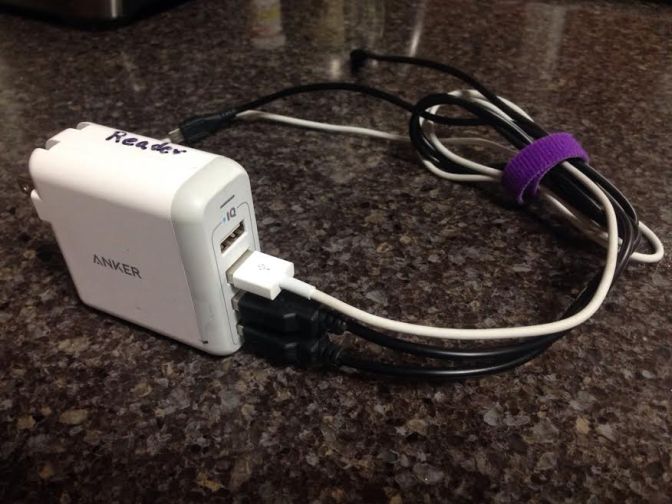
Power cube: It is a good idea to have a small multi-outlet device to allow charging of all your electronics off a single power receptacle. I used one that had four USB outlets and kept my phone and headlamp charging cables plugged into them always. This also kept all my electronics in one place and not scattered about making them easy to find when packing up.
Extra pad and sleeping bag: To prevent having to unpack and repack my pack I had an extra sleeping pad and bag in my resupply bag. This was convenient at later check points where there was no bedding for sleeping.
Zip-loc co-location: Extra-large clear Zip-loc bags are great for co-locating like items (socks, gloves/mittens, hats/buffs, batteries/electronics, etc.)
Wet wipes: A package of these is nice to do a quick clean up if you are not showering.
Food: Have two resupplies of required calories so you can just switch out when needed. Also, have on- the- move food segregated and separately packed. Unused food can be consumed if you are not a fan of what is available at the CP.
Check Sheet: Outline what you need to do upon arrival and prior to departure so you remember.
Spare shoes: See above section on clothing. Also consider having a pair of slippers or slides to kick around in the CP while your race shoes are in the drying room.
Clothing: A variety of tops, bottoms, shorts, etc. to adjust to the conditions. Do not overdo it. It is good idea to change into fresh cloths a couple of times over the event so plan accordingly.
Towel: If you plan on showering.
Toothbrush: You will want one.
Navigation
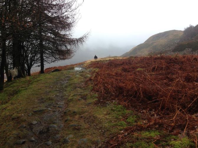
Navigation is something I believe needs to be stressed for this event. This race is not marked in the ultrarunning sense. No little pink flags showing you the way. A majority of this course is through bogs, sheep pastures and other places where a trail is not so evident. The fact that there is over 16 hours of darkness (and I mean country dark) a day adds significantly to the difficulty of finding your way. If you have done night orienteering you know what I mean. You can only see to the end of your headlamp beam. Add fog into the mix and you might only be able to see 20 feet in front of you.

You are required to have a full-blown GPS with loaded GPX files, map(s) and compass and you better fully understand how to use them all in concert or you will be dammed to misery of many hours and miles off course. Even race leaders make navigation errors in this event and you really need to be on your game the entire time, even with sleep deprivation. I can recall over a dozen navigation errors along the way, and I was with someone who knew the course and we were both good orienteers! You cannot rely on just following a GPX route on your GPS! If you are not comfortable with using a map and compass as well as a GPS you should seriously evaluate if you want to sign up for this. Oh, and if you think you can just follow someone, think again. They will be making mistakes too, and looking back at you, they believe that they are on course.
Those who have participated in this event or have “recced” the course before have a huge advantage over those who have not. They know the tricky areas and can focus on route optimization much more than someone who is just struggling to follow the course in some minimalist way.
Harvey’s and AZ Adventure maps (Pennine Way North and Pennine Way South) are preferred over the full-blown Ordinance Survey (OS) ones (much too big). I used the AZ Adventure strip maps and found their scale better than the Harveys, which was helpful in finding which corner of the sheep pasture the gate was in or how to get around a swamp. On the down side, they are not waterproof and require more frequent “page turning”.
Your GPS choice is personal but I would recommend the Garmin 64 series or other model WITHOUT a touch screen (which can have problems under certain conditions). Change your batteries at every check point no matter what the indicated level. I also utilized an app on my Garmin Finex 3 which gave me my British Grid position quite rapidly (double checking against the 64). Speaking of which, if you are used to Lat/Lon or UTM coordinate systems, you need to understand the British system. It is not hard at all, but you need to be able to locate your position on your map when you are inevitably off course.

Some competitors pre-calculated bearings to follow, and used their compass much more than their GPS. This has its place and I believe you will need to utilize all navigation tools at your disposal to finish this event. You will also need to LOOK UP and understand your surroundings. Do not get sucked into your GPS like some teenager and their cell phone.
One final word here is that you will find yourself not only going through private pastures but through people’s yards and farms in places. Be respectful.
Strategies
The strategies that you employ for this event are dependent upon your goals. Are you racing or are you in this just to finish? I believe the associated strategies for these two extremes are very separate and almost mutually exclusive.
Sleep/rest/stopping: Obviously, if you are racing you will accept a lesser amount of sleep/rest/stopping than you would if you are just trying to finish. You need to play this one by ear as you go. Later in the event you are going to need more rest, and other factors will influence how much is available. It should be noted that you must sleep/rest/stop at regular intervals so plan on it. Even sitting down for a meal has its benefits. Those that are racing are resting only enough to get by and no more.
Day/night travel: This is what I would categorize as an advanced strategy. Planning what portions of the course you are on during daylight hours (or during good weather) can help you significantly. You may have to forego some resting/sleep to line things up.
Kit: Racers will have lighter kits than runners will and thus less margin. This is mainly because they are not planning to sleep out on the course and will be spending less time transiting between checkpoints.
Showers: There will be a temptation to take showers at checkpoints that have these facilities. Racers will not. An alternative would be to have a packet of wet wipes in your resupply bag and just wipe off.
Eating: The strategy hear is to eat all the time. You cannot consume enough calories to make up for what you are burning so it is a downhill battle. Eat what ever you like, whenever you like and then munch in between! I lost well over seven pounds (3 kgs) and most likely closer to nine (4 kgs). Having a sit-down meal is nice and you do get some rest at the expense of time. Trying to line up your arrival at public feeding locations when they are open may be challenging. Your call.
Weather
While this year was not considered too “Spine Like” in the weather department you need to be prepared for any and all contingencies. The weather can change rapidly. Wind, rain, snow and cold are expected. Check the weather forecasts upon arrival at the CPs and plan accordingly. Likewise check right before you leave to catch the latest updates. I found that what was available in the forecast department was very general and my not reflect conditions at higher elevations and further away locations. It is fortunate that lightening is rare in these parts but it can occur especially in the mountains. Travel smart.
Training
It is hard to say how to best train for this event. It is so unique. Physically be prepared for day after day of hard exertion. The Fell Runners know what this race is about and I have gained a lot of respect for them. You are going to WALK a lot so be ready for that too. Practice your navigation and traveling at night. Pack training is also a must. Finally, get to know how you operate sleep deprived and how far you can go down that path.
One thing that I was not at all ready for was all the “stiles”. These are the ladder or stair like contraptions that one utilizes to cross over the stone walls separating fields (the ladder types are good to sit on to rest). I have no idea how many of these things I struggled over but it seemed like at least 30 per day! That is not counting the numerous gates that require opening and closing. BE SURE TO SHUT ALL GATES! I was taken to task by one property owner near Cowling about racers in front of me not closing the gates.


Finally, I must say be sure your core strength is up to the task. I most likely focused too much on my running and not enough cross training in the weight room and on the yoga mat. With all the slipping and sliding of the mud I believe I just overexerted my back muscles trying to balance to the point they just shut down. No permanent damage just days of healing and repair. Enough said.
Other
Mental: I must say this is the most mentally taxing event I have ever done. You need to be prepared for this. By the second day you will be beat down hard and perhaps only a third of the way done! If you cannot cope with what is out of your control this will be a very miserable experience.
Logistics: The logistics associated with this point-to-point race are horrendous. It is made even more difficult do to the remoteness and rural locations. Public transportation is very limited and runs on infrequent schedules. Lodging at the finish is in short supply and there is no real place to crash and recover upon finishing. It is even more of problem if you drop. Race personnel will help to their extent possible but plan on being on your own. I was fortunate to have my wife Lisa following the race along. This made my logistics of calling it quits in Byness easy.
Support/un-supported: This race allows you to participate unsupported using only your resupply bag and what you get along the way or supported where a crew can tend to your needs anywhere on the course. Supported racing has advantages (such as sleeping in more convenient spots) if utilized correctly. It can also be a distraction and can add many hours to your time. It appears that the use of support will no longer be an option in the future according to recent posts from the race directors.
Race number/name marking: It is a good idea to mark as many things as possible with your name and/or race number. Poles, socks and other items that may be lying about and could be easily taken mistakenly by others should have unique identifying markings. Shoes too!
Foot care: Over the course of this event I had little issues with my feet. I only had feet swelling (like everyone else) and three small blisters. This pales in comparison to other who lost the skin on their toes (and had to have it sewn back on) or required IV antibiotics due to septic foot infections! I attribute this to good foot prep (tuff foot, nail trimming, etc.), good shoe/sock systems and DRYING MY FEET at every opportunity I had. I slept sometimes with no socks on and when I did wear socks I put on clean dry ones. Foot care is an absolute necessity in this race and there were many DNF’s because of foot issues.
Anti-chafe: Be sure to have a supply of your preferred lube and anti-chafe products. You will need them.
Drying rooms: Many of the check points will have available drying rooms for your use. These extra warm areas will allow some of your gear to dry out while you rest/sleep. Get your gear in there ASAP and keep it all together. Turning you shoes upside down helps if they are extra wet. Be advised that if your gear is not marked well it may not be there when you go to retrieve it! Even with semi-dry shoes, I abhorred putting my feet into them when I was getting ready to go.
Trail conditions: With the Challenger event departing a day earlier than the Spine, the condition of the trail up till CP2 was impacted heavily. There was much more wear and tear and I assume that due to the wet and muddy conditions this was more pronounced than if it were below freezing. Additionally and unfortunately there was also some litter that could be attributed to participants.
Well, there you have it. Quite a bit of information. Hopefully it was, at least, an interesting read!