Over the last year I have struggled like many to keep my running focused with races being canceled or postponed. Stage racing in particularly has been hard hit due to its international nature. Even though running for me is not about competition it is about self (self-improvement, self-reflection, etc.).
I still was missing something. With lock downs, isolation, travel restrictions and the ever evolving new normal putting many things out of reach I found myself looking for a challenge.
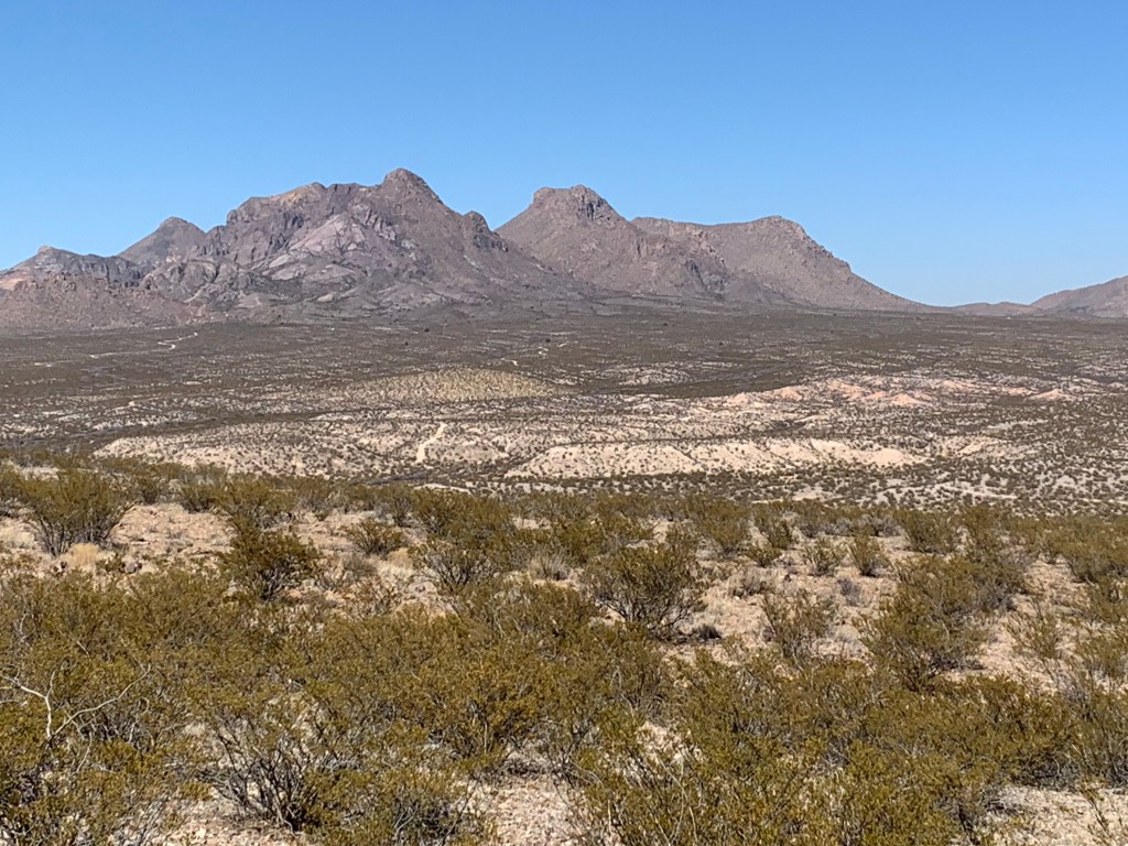
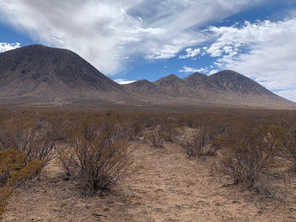
For several years I had been thinking about running the Monumental Loop in southern New Mexico and it became apparent that the time was right to do it. This relatively new and obscure bike packing trail in southern New Mexico was developed by Matt Mason and Pablo Lopez over the last five plus years to highlight many of the wonders of the Mesilla valley and Las Cruces areas. The route is a giant figure eight centered around Las Cruces. Approximately 350 miles in length the Monumental Loop traverses fantastic desert scenery, national monuments, wilderness areas, follows portions of historical trails (El Camino Real/Jornada del Muerto, Butterfield stagecoach route), and passes by many other interesting sights. There is also lots of great New Mexican food along the way. Efforts are ongoing to have the Monumental Loop designated as a national trail.
In addition to this trail being a scenic, historic and a physical challenge it is also around my old hometown. I grew up in Las Cruces and attended university there. Much of the Monumental Loop passes through many places that hold memories from my youth. The chance to reflect on these appealed to me and strengthened my desire to complete it.
There have been only a handful of attempts to run a version of the Monumental loop since its inception. The running version is approximately 300+ miles in length due to a pedestrian cut off in the West Potrillo Mountains Wilderness Study Area and to date there has been only one success (in 2018 by Ella Raff). Peter Livingston from Las Cruces has also made two valiant attempts to complete the entire trek, one in mid-summer! Peter is a wealth of information regarding running the Monumental Loop.
Planning
Planning for this monumental undertaking was actually not too significant. I had originally planned to run the loop self-supported as a challenge, but I also wanted to give anyone an opportunity to run with me for any or all of the way. With that in mind I decided to do a “semi self-supported” event. Basically, I would run self-supported and with anyone who cared enough to come along. In the end I had company for about sixty miles of the Monumental Loop. The rest of the time I was on my own.
Getting ready I reviewed Ella Raff’s blogs, did map reviews, worked with Peter Livingston on logistics and other information and came up with some semblance of a plan fully aware that it would change.
Route and water were the main issues with determining the route being the most difficult. Since this is a relatively new trail, there are options to consider. After talking to Peter, I decided on executing the Tonuco mountain route along with the West Potrillo Mountains Wilderness Study Area pedestrian bypass. The later shortens the distance compared to the mountain bike route since the bikes are not permitted to cross the wilderness area. It also offers more trail running as opposed to dirt roads. Overall, I was estimating approximately 300+ miles. One interesting note on route planning is which loop (north or south) to do first and the direction of travel for each loop. I am sure there can be some optimization depending upon many factors, but I just decided to do the north loop counterclockwise first and then the southern loop in the clockwise direction.
Water in the desert is no joking matter and since I was going to do this in a semi-self-supported fashion, I needed to ensure availability. Along the Monumental Loop there are many cattle stock tanks as well as the Rio Grande River and local stores and restaurants. Availability of all of these would need to be verified but I just did not have the time so I decided to stage water drops at strategic locations and not depend on remote sources. In all, I had ten water drops which are discussed below. Reliable water was planned for about every 20 miles but on the southern loop it stretched to 40 miles in the wilderness area.
| Planned Water Locations/Drops | ||
| Location | Millage | Comments |
| McDonalds | 21 | Dollar Store down the street |
| Dona Anas drop | 43 | 1 gallon |
| I-25 Rest Stop | 57 | |
| Hatch | 76 | |
| Las Uvas drop | 88 | 2 gallons |
| Corralitos Ranch drop | 121 | 1 gallon (water tank available) |
| Picacho Hills drop | 140 | 1 gallon |
| Mesilla/Las Cruces | 150 | |
| Sierra Vista Trail Head – Las Cruces drop | 166 | 1 gallon (plus food) |
| Sierra Vista Trail Head – Vado drop | 179 | 1 gallon |
| I-25 truck stop | 198 | |
| Lanark Tank drop | 218 | 1 gallon (water tank available) |
| Wilderness Cut-off drop | 228 | 2 gallons |
| Railroad crossing at Aden drop | 268 | 1 gallon |
| Final drop | 285 | 1 gallon |
With all of these details determined I then focused on the when aspect. Typically running attempts of the Monumental Loop have occurred in October and coincide somewhat closely to the Danger Bird mountain bike festival on the Monumental Loop. That timing would be too late in the year for me due to other commitments. I decided to try for the end of February to the first part of March since there are similar day/night temperatures then and little rain. This is also typically before when the horrible spring winds of southern New Mexico begin blowing
I initially planned on starting my attempt on February 27th in order to coincide with a full moon (great running conditions at night), but due to family commitments I had to move that up by a week. Little did I realize that this change would impact me fairly significantly due to the record cold front the swept into New Mexico and Texas just prior.
February 19th – Water drops
My wife Lisa, our dog Tawny and I headed down to Las Cruces the evening of February 18th. Upon arriving in Las Cruces, the primary task was to put out my water drops. Even though most drops were selected for ease of vehicle access it took the entire day. There was lots of driving (estimated to be about 300 miles with many of them on dirt roads). I buried my one-gallon jugs in the sand to keep cool and to make sure they did not disappear over the following days.
When that was completed, I treated myself to a takeout dinner from Si Senor, one of my favorite Mexican Food restaurants in Las Cruces and then prepped my kit for an early departure.
February 20th: Start to I-25 Rest Stop (about 59 miles)
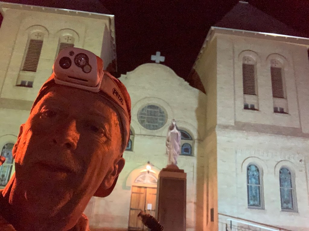
My start was scheduled for 6 am on Saturday morning. Peter wanted to accompany me for the first day and on our way down to the start in the heart of old Las Cruces Lisa and I picked him up. Our departure was without fanfare and Lisa and our dog Tawny saw us on our way. Peter and I took our time through the residential areas and eventually out of town and around Tortugas Mountain (also known as A-mountain due to the large “A” painted on it for New Mexico State University Aggies). From that point there was some nice trail running.

As we neared the 20-mile mark we came across members of the Onate High School cross country team out training. They were all quite friendly, but I did have to tell them to watch out for Los Alamos. We made our first stop at a McDonalds at Highway 70 (the Bataan Memorial Highway as in the Bataan Death March where many New Mexicans suffered and died) just before lunch. It took some time to order our food due to COVID restrictions that would not allow us to go inside to the counter (had to use the app). Lisa met us there and visited until we set off again and, on our way, out we had to swing by a Dollar Store to stock up on water.
The Dona Ana mountains began to loom large and we reached the first portion of the Organ Mountains Desert Peaks National Monument. A heavy mountain bike presence and many associated trails necessitated frequent GPS usage, but the trails eventually thinned out as we reached the northern regions of this small but impressive mountain range. The rough and rocky trails gave way to sandy washes and we made our water drop just before sunset. I had just enough water to get to the drop and was a little dehydrated but soon was good to go again.
Peter and I still had some miles to go before calling it a day, so we moved out as darkness began to fall. Even with a partial moon it was dark and route finding was a little more challenging. I enjoy running at night and like to see the stars, moon and wildlife that are out and about then. During this section there was and abundance of small spiders. Their eyes would reflect a turquoise blue in your headlamp just prior to them scurrying away.
We finally reached the rest stop located along I-25 at about 11 pm. As we were unloading our packs, a Boarder Patrol car roared up to us and an inquisitive agent approached us with some questions. We had a report that there were two individuals walking in the desert not far from here heading north are you them? (Yes sir, we are running the Monumental Loop – brief explanation followed). Were you two using walking sticks? (Yes, as we held up our poles). Obviously, we had been detected by the Border Patrol check point located a mile or so up the road, most likely via the infrared spectrum.
The agent thanked us and explained that they did not wish to be running around the desert looking for people they did not have to in the middle of the night. While this encounter may seem a little draconian to some, it is their job and the occurrence of “immigrants” in the area is real. Evidence of their presence is also apparent on the southern loop. The agent bid us a good night and I thanked him for his service. As an aside, my brother Dirk and I got a similar visit when we were running on the El Camino Real trail/Jornada del Muerto back in December in 2013 about 10 miles to the north.
We eventually had some food and settled down for a not so peaceful night due to highway noise and trucks coming and going at the rest stop.
February 21st: I-25 Rest Stop to Las Uvas (about 48 miles)
We wound up sleeping in a little even though the plan was to get a much earlier start. We were on our way before sunup and just before the Tonuco Mountains, Peter turned south to return home. He had some commitments that required his attention and now I was on my own.
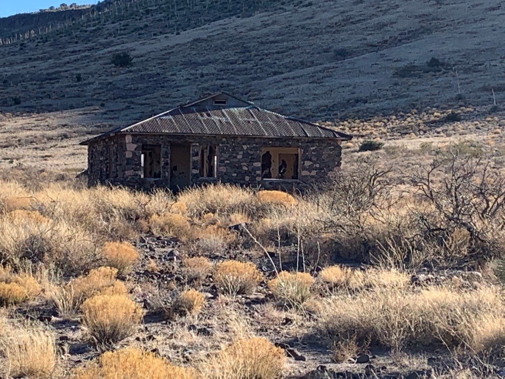
The Tonuco mountains are rugged and rarely visited. Remnants of old mining works still exist and are somewhat eerie. From the top, you can view the Hatch valley to the north and the path you will be following.
The roads and trails eventually lead you into Hatch, the Green Chile Capital of the world! Along the way there were pecan orchards and flocks of noisy sand hill cranes. Fortunately, I was arriving when Sparkys (a local eclectic burger joint) was open, and I had a glorious Green Chile Cheeseburger and fries for lunch. Green Chile Cheeseburgers are a New Mexico staple which everyone should try it at least once in their life. If Jimmy Buffet had tried one the song would be Green Chile Cheeseburger in Paradise!

While in Hatch I picked up some supplies and eventually located a couple of additional battery power packs to help alleviate the power issues I was having. That cost me some extra time. I finally got out of town and was heading east to the north end of the Sierra de las Uvas (the Grape Mountains). I reached my water drop and loaded up with all the water I could carry prior to starting into the hills.
My heavy pack slowed me down and as I made my way it became apparent that I had over planned. Stock tanks were viable and there were also an additional one that was not noted on course GPX files. When I approached Big White Gap, to my surprise you could still see snow in some place. This had me a little worried. It was going to be cold tonight!
Darkness descended and the temperature started to drop along with the wind picking up. I was feeling tired and wanted to find a decent spot to camp. As I made my way along, I noticed a pair of greenish-gold eyes from up high in the rocks staring down at me. My headlamp could not illuminate sufficiently for a positive identification but by the way the creature moved and its location in the rocks I am fairly confident my observer was a mountain lion and not a coyote or bobcat.
Finally, around 8:00 PM and at about mile 100 I called it quits for the day and made camp. After a quick dinner I bundled up and tried to get some sleep in the cold and wind.
February 22nd: Las Uvas to Las Cruces (about 55 miles)
I was up early mainly because it was still windy and cold but also because I wanted to get moving. After a quick cup of coffee and some breakfast I was on my way down the trail. The first hour or so it was in the dark and I missed seeing the scenic Hidden Valley because of this. Soon the sun was up, and I was able to remove warm clothes and start making my way out of Las Uvas and onto the plains south of there.
The day warmed up nicely and soon I was at my water drop at the Corralitos Ranch tank. Eventually the trail turned east, and I began the ascent into the southern Robledo mountains. While the going was easier than in the Uvas, there were some long slogs uphill. Paying attention to navigation started to become important again when the track turned south. More and more trails appeared and when you got closer to Picacho Peak options were everywhere. There were several navigation errors and a little bit of frustration that I was not paying close enough attention. As I made my way out of the Picacho Peaks subdivision, Peter showed up to cheer me on with some encouragement. It was nice that he drove out to say hello.
I had hopped to get a bite to eat toward evening, but nothing was really available in the vicinity except for Pic-Quick where a cold coke and a snack bite sufficed. It would hold me over until Mesilla or Las Cruces where food options were conceivably better.
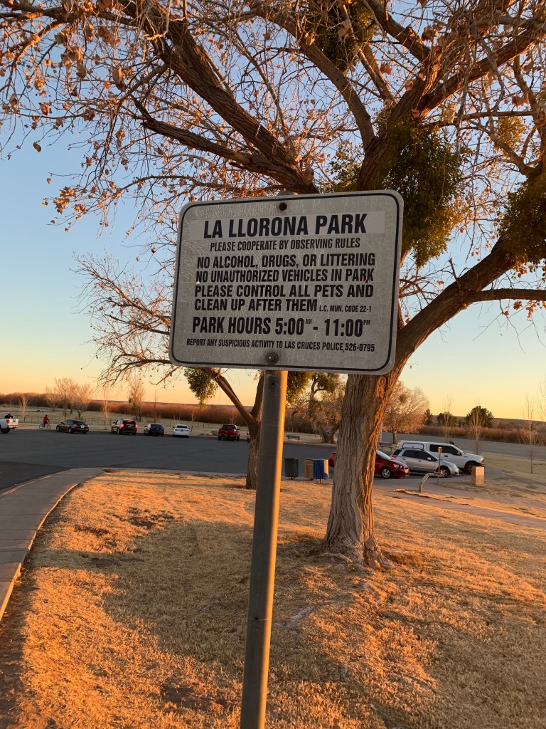
The sun was setting as I made my way past La Llorona park along the Rio Grande. For those of you not familiar with La Llorona, legend has it that a beautiful woman named Maria marries a rich man with whom she has two children. As their marriage deteriorates, she sees her husband with another woman and in a fit rage she drowns the children in a river so they could not be taken from her. Maria instantly regrets her actions but is unable to save the children and is so consumed by guilt that she drowns herself. Unfortunately, she is unable to enter the afterlife without her children and wanders the waterways wailing and looking for them. This tale is told to children in New Mexico to keep them away from dangerous waterways. Only in New Mexico would you build a park named La Llorona, along a waterway.
My pace had deteriorated, and I eventually made the plaza in Mesilla at approximately 7:30. I had reached the halfway point in about two days 13 hours! Not too bad but I needed some serious rest. So instead of trying to make another 15 miles out of town I decided to continue into Las Cruces and catch a good night sleep in a hotel near the University along the route. On my way I grabbed a burger, fries and a chocolate shake that significantly helped the low blood sugar issues I was having.
Once I was checked in, I set about prepping for the second loop. Foot care (not too bad), recharging everything, rinsing out socks, repacking and even a shower! Soon after I was down and out for some a some much needed rest.
February 23rd: Las Cruces to outside Vinton (about 58 miles)
Fully recharged I was up early. Today would be a good running day. I grabbed some breakfast in the hotel lobby and Peter showed up to see me off. It was getting light as I made my way through the campus of my alma mater, New Mexico State University. I passed the College of Engineering and the buildings where I attended classes in my younger days. I wound my way by Corbet Center (the student union), dormitories and the Pan American Center and football stadium. This little section brought back a lot of memories. After rounding A-Mountain for a second time I arrived at the Sierra Vista Trail Head and my water/food cash where I had plan to be at some 12 hours earlier. Everything was intact and I was reloaded in short order.
At this point the Monumental Loop follows the Sierra Vista Trail which runs north/south in the foothills of the Organ and Franklin mountains. This trail is very runnable and is perhaps some of the best desert trail running around. I really got into my form and made some time. It was an excellent day for running; relatively cool, clear skies and beautiful scenery. Soon I was at my water drop near El Vado and pressed on south through some very sandy sections. As I approached Anthony Gap, I caught a toe and took my one and only tumble on this adventure. Nothing major just a little scrape and a sore kneecap.
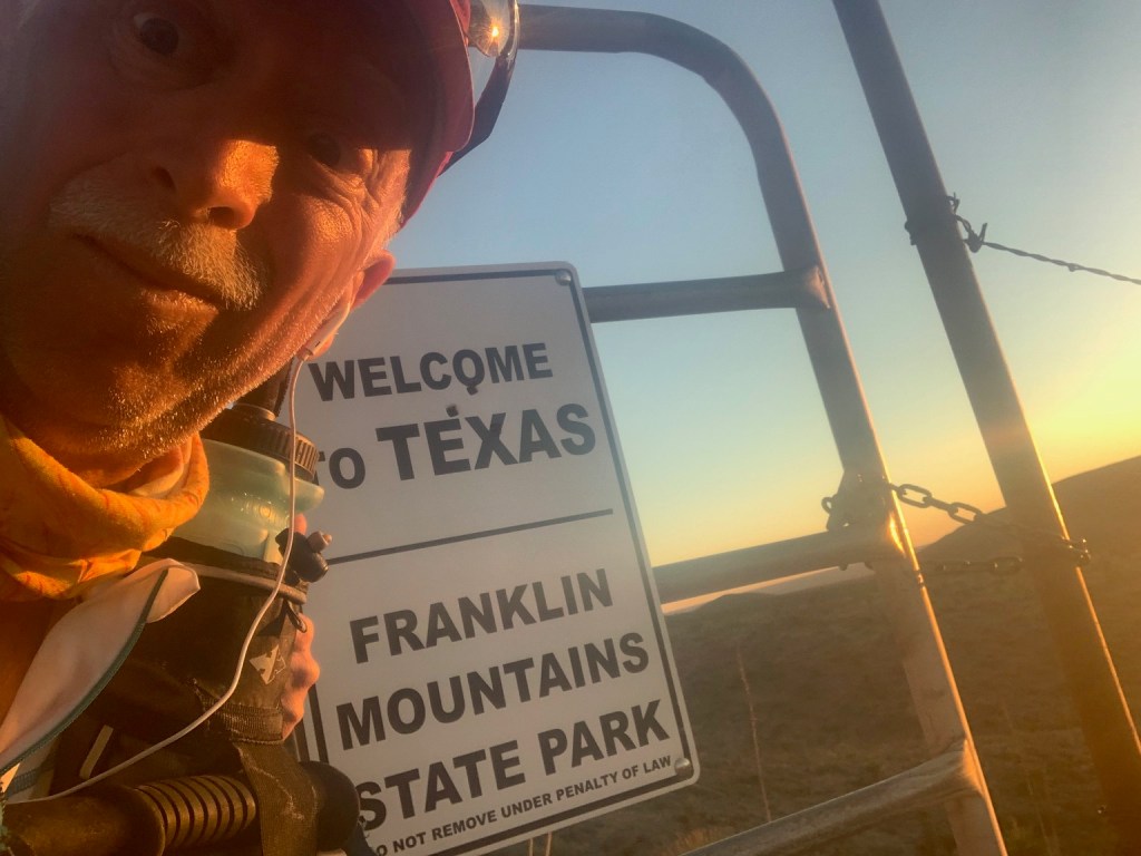
I made the Texas boarder at sunset and wound my way through the Franklin Mountain foothills and down to I-25. By then I was feeling fairly tired, so I tanked up at the truck stop on a Subway sandwich, chips, and a Coke. I also resupplied with some Pop-Tarts, candy bars, batteries, and other essentials. Since I did have a way to go before I could get to a spot to sleep, I reluctantly packed up and headed out.
Winding my way along the country roads I finally came to the village of Vinton. I felt bad passing through late in the evening because I believe that every house in Vinton has at least one dog and every single one of them thought it would be a good idea to cheer me on with a chorus of extremely loud barking. I guess the residents of Vinton or used to it since very few lights that came on in response.
Eventually I pulled off the road and bedded down in some soft sand for some shut eye. Even though I was over two thirds of the way done the next couple of days were going to be tough and I was slightly behind where I wanted to be at this point and time. It was time to revise my plans and start to go with the flow.
February 24th: Outside Vinton to West Potrillo Mountains Wilderness Study Area (about 33 miles)
Not a good day. Early on my lower back started giving me some problems so I slowed down and did a lot more walking. Even though I had been getting sleep it was not enough and I was very tired.
But early on I still had to push it. Making my way down the road to a set of railroad tracks I heard a train fire up and start their series of whistle signals getting ready to move. I did not want to wait for the long parade, so I poured it on to get over the tracks before they got moving. Made it!
But then I ran into another issue. While we were stocking the water drops previously, there was a road grader sitting at the turn off to Kilbourne Hole. It was no longer there but had been replaced by a government truck. I trudged along and eventually caught up to the road grader! While smoothing the road out for vehicles is nice it did chew up the road and made it a little sandy. I was also having to slow down since the operator was taking his time. Eventually he saw me in his rear-view mirror and picked it up some ultimately turning off onto a different road.
I passed Lanark Tank and my water drop there and made Kilbourne Hole a little before noon. Kilbourne Hole is a volcanic Maar which is a pit or depression caused by a volcanic explosion where little material is ejected except for volcanic gas. NASA astronauts trained at Kilbourne hole and the surrounding Aden lava flows for moon missions in the 1960’s.
Several hours later I made my next water drop in the shadow of Mount Riley and at the start of the West Potrillo Mountains Wilderness Study Area cut off for the pedestrian route. After rehydrating and a short nap, I packed up and headed off for the longest waterless section on the Monumental Loop.
A couple hours after sunset I made my camp and dinner. Early in the night the temperature dropped sufficiently enough for me to pull out my bivy sack and added that to my sleeping system. This helped immensely and I wound up sleeping reasonably well.
February 25th: West Potrillo Mountains Wilderness Study Area to Final Camp (about 46 miles)
In fact, I slept so well I added an extra hour of sleep in the morning. Water bottles were showing signs of starting to freeze so it was apparent that the temperatures dropped into the low 30s or upper 20s.
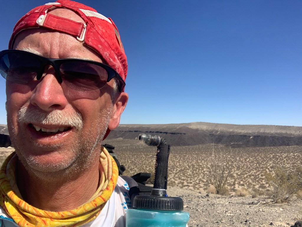
This day was all about steady progress. I had to make about 45 miles with the water I had, and the trail was either rocky or sandy with no real in between. Slogging along there was eventually a fair number of cattle moving in the general direction I was heading. There paths weave back and forth creating interesting patterns. When you see cattle heading in one direction in the desert it means only one thing and that is water. That gave be a little hope that I might be able to top off and add a little more margin in the hydration area.
Towards mid-morning I caught a glimpse of an animal running across my path about 300 meters ahead of me. My first thought was that this was a coyote, but it seemed large and did not quite move like one. I just filed it in my head and continued on until I came across a large water tank on the trail. Good, time to see if there was some water. Momma and baby cows were everywhere and not wanting to upset them I began making my presence known and allowing them the opportunity to move out of the way. As I approached, the rancher and his wife walk out from behind the large water storage tank! I apologized for moving his cows, but he was good with it. They were there to fix the water system to this tank which was broken. There was no water here.
They listened to my story with a little disbelief and commented that perhaps they would ride the horses that far but no way attempt this on foot. The rancher then asked me if I had seen any wolfs. Bingo, the light went on! The big coyote I had seen earlier was most likely a Mexican Grey wolf. The rancher indicated that they were in the area and that they had not been seeing too many coyotes lately.
After a little more chit chat, I took my leave and left them to their plumbing problems. Several more miles later I came to another one of their water tanks but by then I was confident enough that I had sufficient supplies to make my next water drop. I did not want to take the time to filter water. Shortly there after the pedestrian cut-off rejoins the mountain bike route in the vicinity of the rancher’s house where in an emergency water could be available.
The day grew hot, and it was becoming a slog. I took time out to empty sand out of shoes, do some foot care and change socks since I was beginning to develop some blisters. One may want to consider bringing along gaiters for the southern loop.
This portion of the Monumental Loop is probably the most desolate. The trail winds it way amongst ancient volcanic cones. Matt Mason has coined a term “cone country” for this area and it is an accurate description. All the time I kept thinking about the old John Wayne movie “The Three Godfathers”. If you have seen it, you know what I am talking about. If you have not seen it you should watch it, it is a great western.
I finally made my water drop at Aden a little before sunset. I fixed me a luxurious treat of blueberry crumble dessert for an early supper and took a little break. I was ready to be done but had about 26 more miles to go. I reluctantly got up and started making my way north to the Mesilla valley.
I was contemplating pushing it all the way in that night, but I was spent. It had been a long and hard day. I managed to get some more miles in before I pulled off the road and fixed a quick bite to eat, and crawled into my quilt for some sleep. Tomorrow I would bring it on home to the finish.
February 26th: Final Camp to Mesilla (about 12 miles)
It got downright cold (even in my book) overnight. I woke to frozen water bottles and the desire to stay in my sleeping quilt. I was just able to fix some lukewarm coffee and breakfast with my remaining fuel and food. I had no more margin left but only 12 more miles to go. The thought of a huge brunch of huevos rancheros got me motivated so I packed up and moved out.
At my last water drop I was able to get some water out of the partially frozen gallon that had been buried there. That would get me into town. The sun rose over the Organ mountains and temperatures thankfully began to climb.
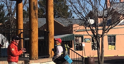
Soon I was down in the valley amongst the pecan groves with just a few short miles to go. Up ahead I saw Peter’s truck and there was someone else with him. To my surprise it turned out to be my brother Dirk. He had flown in the night before to see me to the finish. What a surprise! We ran along together, and he bragged about me to every passerby, including the local fire chief who upon hearing the story, gave us a lighted escort into the plaza.

It was a small, but heart felt welcome of Lisa and Tawny, Peter, family friend Paul Bridger, and Matt Mason and his girls as well as. They had chairs set up on the gazebo in the middle of the plaza into which I sank. It was done! The time was about 8:50 in the morning – six days, two hours, and 50 minutes.
There was all sorts of food and drink. Matt had even stopped on his way and picked up some food for me. He did not know what I wanted so he brought a serving of pancakes and a serving of huevos rancheros! Guess which one I ate. After a bit of recovery Matt presented me with a Monumental Loop hat for my accomplishment. What a neat gift from the founder of this trail!
Eventually things wound down and everyone needed to get back to life. I was in serious need of a shower and some rest myself. The Monumental Loop adventure was over.
Kit
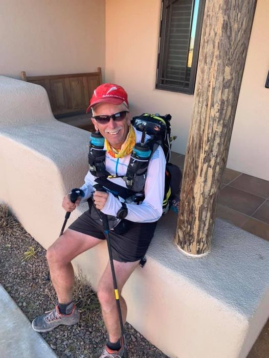
Now for some words on my kit. I started with a typical Stage Race/Multi day kit that I usually use but made some modifications for this run.
- I used a cut down Therm-a-Rest Z-lite foam pad instead of my typical blow-up NeoAir XLite due to the reality of stickers and other pokey things in the desert. I paired that with my Enlightened Equipment custom quilt which was comfortable to around freezing.
- SOL Emergency Bivy sack instead of a sheet. I selected this in case of bad weather. Glad I had it since temperatures dropped into the 20s some nights and it became an integral part of my sleeping system.
- Additional water capacity was needed. I chose to have many options available in case there was a failure (which there were two – I lost the lid to the standard water bottle which I improvised a solution for and a thorn puncture of my Platypus on the last night). I went for about 5.0 liters total capacity spread across:
- Katadyn Water filter – 0.6 liter
- Platypus 2-liter bladder
- 1-liter standard water bottle
- 2ea 750 ml bottles Raidlight bottles
- I added a MSR Pocket Rocket stove and one 4-oz Isopro fuel canister for preparation of meals and coffee in the morning. A little luxury, and just enough for all my cooking.
- All sorts of batteries and extra electronics filled up my pack. Cell phone, charging cables, GPS (backup), power packs (3), etc. I was not quite as prepared for this aspect as I would have liked, and it caused worry almost the entire run. In retrospect I should have found a solar option.
- I included my Black Diamond Carbon Distance Poles
- Clothing was minimized. I did plan on “cool” weather but not cold. I would wear all my clothing at night and early in the morning until it warmed up.
- Montebell puffy with hood
- Light weight Montebell wind breaker
- Raidlight long sleeve desert shirt (wore this daily)
- Shorts
- Short sleeve shirt
- Tights
- Buff
- Warm cap
- 3 pairs of socks (would have liked to have had more!)
- Running Hat
- 2,500 kcals per day food with me. I would have been better to have more food to eat while moving. Electrolytes (tablets/Tailwind/Scratch) are a must.
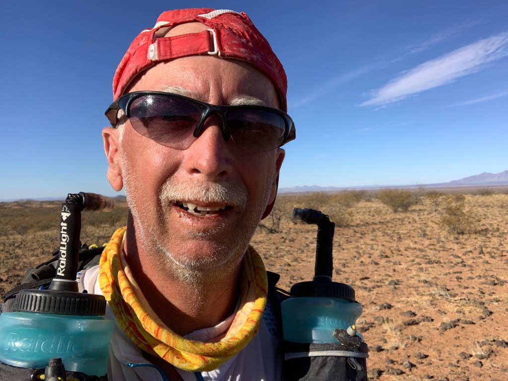
Overall, I was at about 13 lbs dead weight/food and up to about 12 lbs water (typically only 2.5-3 liters/6.5 lbs). This was not too bad for a self-supported effort like this but the two days when the pack was over 20 lbs you could feel it! Overall, kit worked out fine and I would recommend only minor modifications to it.
Physical Impacts:
This was a particularly rough run for me. I definitely lost some weight (about 10 pounds) and should have tried to eat more especially when at stops. The bottoms of my feet took a beating in the Uvas and I eventually got a couple of blisters. I survived the sun well enough with the exception of my bottom lip which did get sunburned. That made post event eating a little painful! Overall, it took about two weeks to fully recover and gain some weight back.
Course Notes:
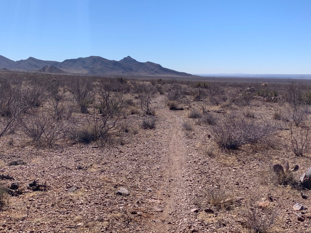
Now for some words on the course. First and foremost I have to say that this is an incredible desert run (or ride). Running the Monumental Loop is an impressive challenge especially if done self-supported or unsupported. Even doing one of the loops (or certain parts) would be excellent training for any desert stage race such as the Marathon des Sables or the Grand to Grand Ultra. Hopefully notoriety will attract more to enjoy it.
As stated above the Monumental Loop is relatively new and is constantly undergoing updates and improvements. It offers something for almost everyone from an urban environment to one of remote isolation. Deserts, mountains, sand, and rock. In places it is difficult to follow due to the spiderweb of other trails (as in the Dona Anas and around Picacho Peak) and thus you are referencing your navigation equipment frequently. There are also some sections where the route leaves a main trail or road for a short section (only hundreds of meters) and thus it is hard to follow again requiring you to pay more attention to the GPS than the scenery. Eventually, when the trail is officially designated and recognized, signage will help alleviate some of these issues.
The compilation and publishing of more “official” GPX files would help immensely including detailed way point descriptions (particularly water locations, resupply locations that are open 24 hours a day, scenic points, and important junctions). It would also potentially fix the issue observed at times that the GPS track I had did not line up well with ground details some times.
The northern loop is the more difficult of the two in my opinion and I was glad I went that direction first. There is more elevation gain/loss and the La Uvas mountains are very rugged. Feet will take a beating there! There are more road miles on the northern loop, but they are a necessity to tie this wonderful trail together. The Tonuco mountain alternate is interesting but adds just a touch more road miles. Overall, this alternate is approximately the same length as going on the original route through Rincon.
The southern loop is more desolate overall. The Sierra Vista trail at the base of the Organ and Franklin Mountains is one of the most enjoyable desert running trails in New Mexico. The area around Kilbourne Hole and the West Potrillo Mountains Wilderness Study Area is very remote and in places quite sandy. Trail selection here is excellent especially the in the wilderness area. Of course, upon nearing Mesilla, you begin to follow more roads that while quite runnable, are to some extent a little boring.
Cell phone coverage over the route is fairly respectable for New Mexico. There are some miles in the Las Uvas and the West Potrillo Mountains Wilderness Study Area where there is no or very limited signal. Even so, it would be good to plan on regularly scheduled check ins, provide timing estimates and perhaps utilize a satellite tracker.
In addition to the Identified water locations there were some others of note that can be added.
- Las Uvas (32.536828 N, 107.200128 W?)
- Picacho Peak (32.33981 N, 106.879869 W)
- Kilbourne Hole (31.95820 N, 106.94745 W)
- Wilderness area (32.04567 N, 107.22470 W and 32.04172 N, 107.25154 W)
The one near Kilbourne Hole was nice and clean and I picked up a liter or so there. I believe that with some good planning one may be able to run the Monumental Loop even unsupported.
Acknowledgements:
Adventures such as these are rarely done without help of many individuals. My Monumental Loop run is no exception.
- Matt Mason: One of the founders and creators of the Monumental Loop (along with Pablo Lopez). Thanks for the brunch and the hat!
- Peter Livingston: Local trail enthusiast and trail/ultra-runner. Peter was instrumental with planning and provided company along the way. Your support made this run happen.
- Ella Raff: A pioneer for being the first to run this.
- Lisa: My exceptionally supportive wife. I am lucky to be married to such a jewel.
Resources:
Here is a partial listing of resources that the reader may find interesting or beneficial if they wish to attempt a Monumental Loop run or ride
https://bikepacking.com/routes/monumental-loop/
https://www.facebook.com/monumentalloop/
https://ellaraff.wordpress.com/monumental-loop-2018/
hhttps://www.blm.gov/visit/omdp
